Hyfix india
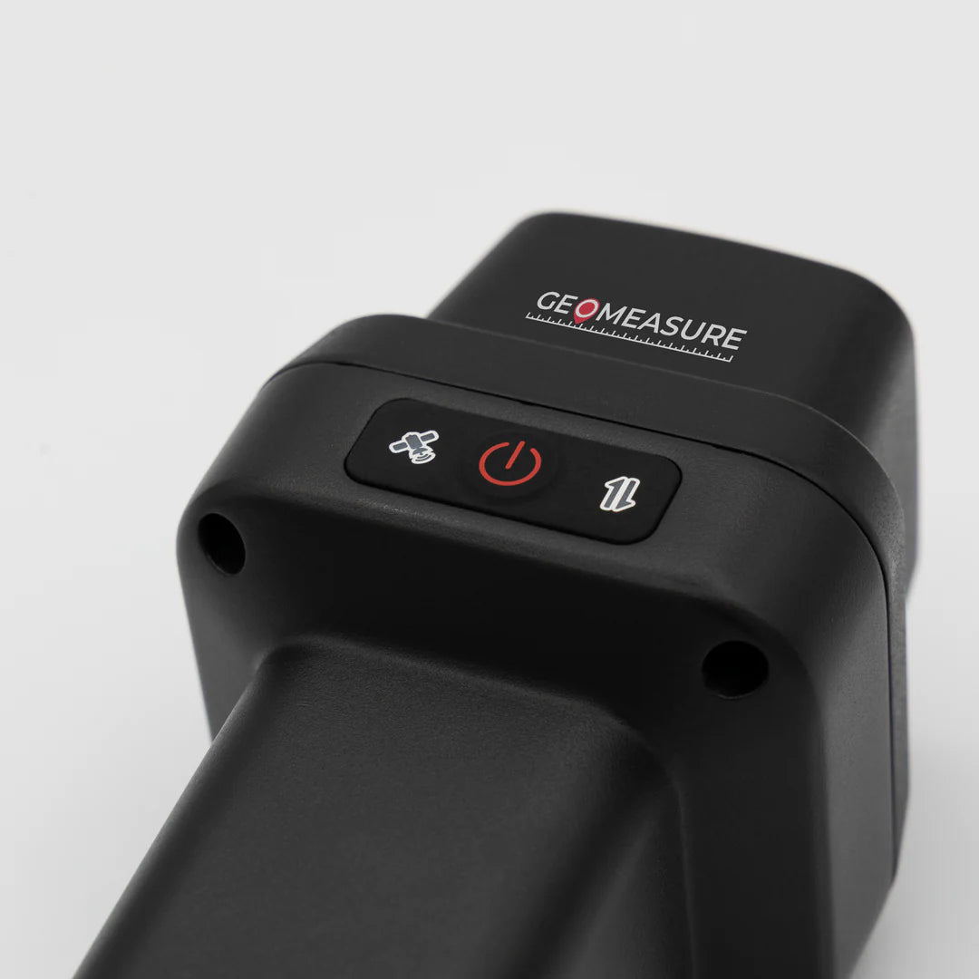
GEO-MEASURE: Handheld GNSS RTK Receiver
GEO-MEASURE: Handheld GNSS RTK Receiver
Couldn't load pickup availability
PLEASE NOTE THAT THIS ITEM IS AVAILABLE FOR PRE-ORDER. UPDATED LEAD TIMES WILL BE PROVIDED AS SOON AS THEY BECOME AVAILABLE.
GEO-MEASURE is a fully integrated handheld GNSS RTK receiver engineered for professionals who demand reliable precision in the field. Designed for surveyors, construction crews, mapping specialists, and measurement professionals, this compact RTK torch delivers centimeter-level accuracy in real-time, without the hassle of bulky external antennas or cables.
With multi-frequency support for all major satellite constellations (GPS, GLONASS, Galileo, BeiDou), GEO-MEASURE provides fast, dependable positioning even in urban, obstructed, or remote environments.
Key Features
- Centimeter-Level Accuracy – Professional-grade RTK performance in a handheld unit
- All-in-One Helix Antenna – Integrated GNSS, Wi-Fi, and Bluetooth for seamless connectivity
- Complimentary 1-Year GEODNET RTK Subscription – Out-of-the-box network access for correction data
- Lightweight & Portable – Compact design built for field mobility
- Long Battery Life – Ultra-low power consumption with up to 30 hours of continuous use
- Fast Charging – 30W quick-charge support to get you back in the field faster
- Cross-Platform App – Control and manage data easily via the GEO-MEASURE app (Android & iOS). App development is being finalized and will be ready soon. Stay tuned!
Why Choose GEO-MEASURE?
Traditional GNSS equipment often requires multiple components, complex setup, and high costs. The GEO-MEASURE RTK Torch simplifies professional surveying by providing:
- Plug-and-Play Setup – Begin work immediately with included GEODNET subscription
- Rugged Reliability – Built for outdoor, industrial, and construction site conditions
- Precision Without Compromise – Maintain accuracy in dense urban areas, forests, and challenging terrains
- Cost-Effective Solution – Affordable compared to traditional surveying kits
Perfect For:
- Land Surveying & Construction – Layouts, staking, boundary marking, and inspection
- Civil Engineering Projects – Roadwork, utilities, and infrastructure development
- GIS & Mapping – Collect high-accuracy geospatial data for research and planning
- Agriculture & Smart Farming – Precision field measurements and equipment guidance
- Utility & Infrastructure Inspections – Pipelines, telecom, and powerline positioning
-
Outdoor Enthusiasts – Hikers, explorers, and off-roaders can log precise trails, mark points of interest, and navigate confidently in remote areas.
Please contact info@hyfix.in for orders more than 3 units.
WARNING: Online Store will automatically charge your selected payment method at time of order. Shipment dates ARE NOT guaranteed.
GST as applicable, Free Shipping within India.
Share